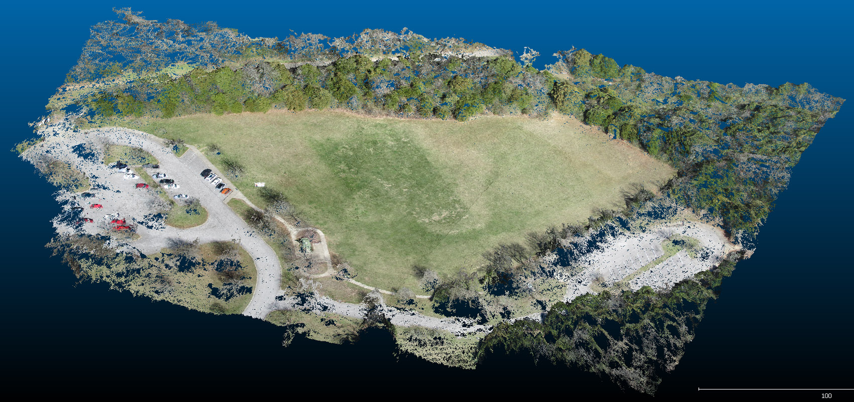
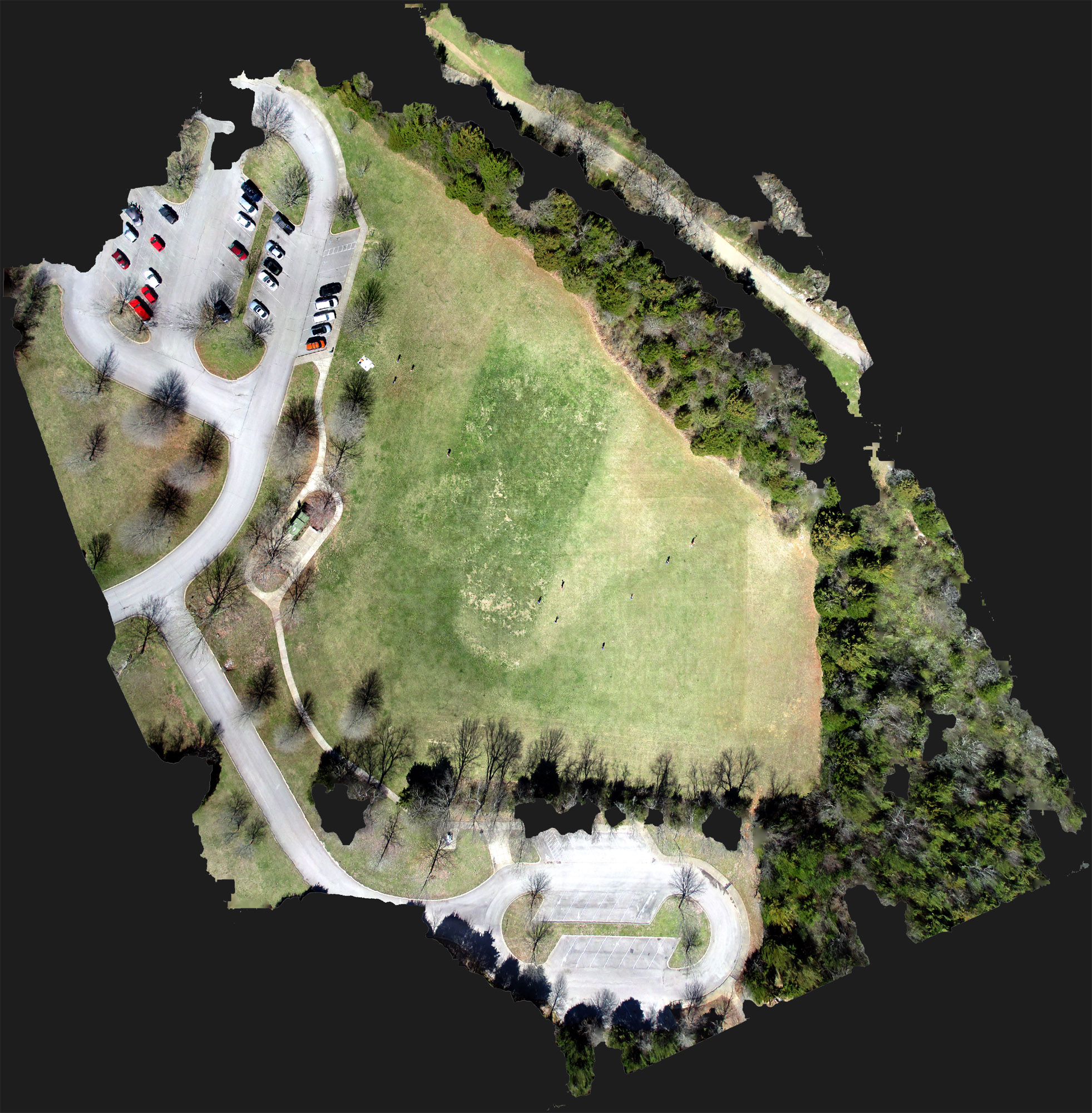
Like any other aerial imagery, automated photogrammetry techniques can be applied to KAP images. Here are some 3D visualizations of the Greenway imageset from October 28th, 2014. The point cloud and orthophoto were created using AgiSoft's PhotoScan software, and the point cloud is visualized with CloudCompare.